Question 1
Which of the following does not prove that the earth is spherical in shape?
Objective
Practice each question, then open it to see the full details.
Study the map extract on a scale of 1:50,000 and answer the following questions:
(a) On the map, mark and name one example of each of the following features with the letters in bracket:
(i) Spur (SP);
(ii) Gentle slope (GS);
(iii) Watershed (WS);
(iv) V-shaped valley (VS).
(b) In your answer booklet;
(i) calculate the length (in km) of River Dakorobi from its source to the point where iL joins River Sencha. (Show all workings clearly);
(ii) describe the relief of the mapped area.
(c) Highlight the influence of relief on settlement in the area. P
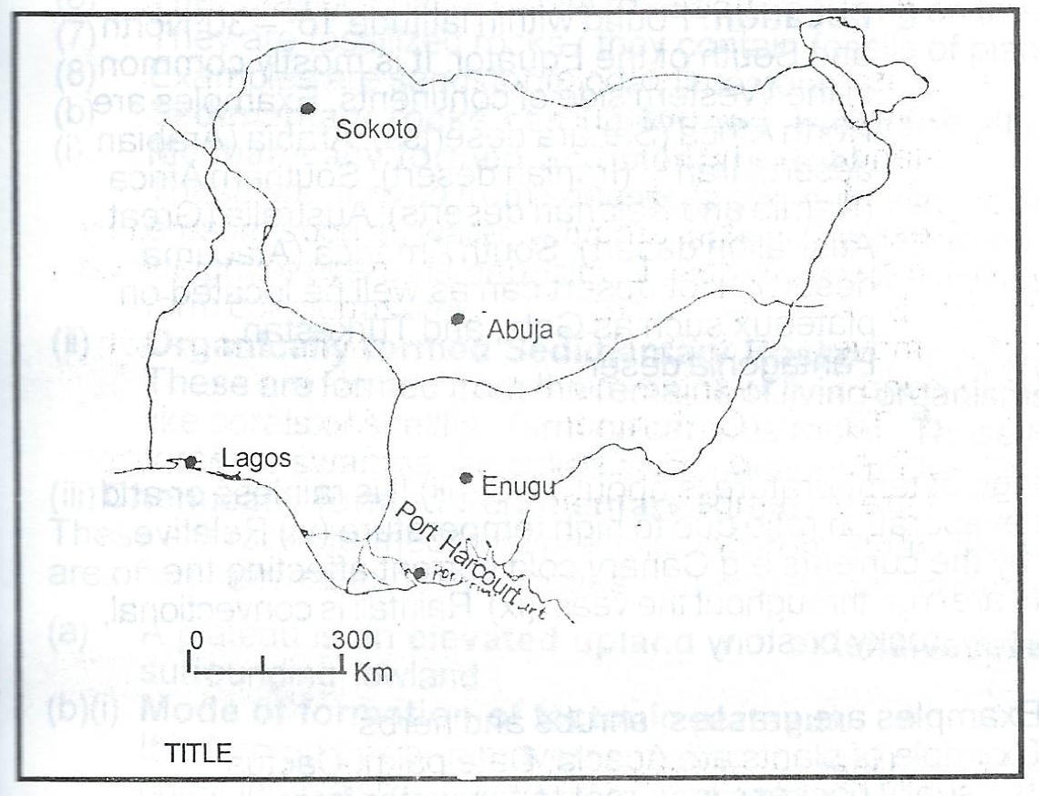
The Table below shows the volume of air passenger traffic between Lagos and four other cities in Nigeria in 1985. Study the table and use the data in it to answer the questions that follow:
| S/N | Route | No. of passengers |
| 1 | Lagos - Abuja | 500,000 |
| 2 | Lagos - Enugu | 200,000 |
| 3 | Lagos - Port Harcourt | 400,000 |
| 4 | Lagos - sokoto | 300,000 |
(a) Using the attached map of Nigeria - Map B, construct a flow map/chart to represent the data in Table 1.
(b) State two advantages cf representing data with flow maps.
Write a geographical account of Hot Desert Climate under the following:
(a) Location
(b) Characteristic features,
(c) Vegetation,
(d) Human activities.
(a)(i) Define the term Environmental Resources,
(ii) List two types of Environmental Resources other than water.
(b) Highlight four ways in which water is important as an environmental resource.
(c) Outline two problems that might arise from the degradation of water resources.
(a) Draw a diagram to show the relief features of an ocean floor.
(b) Highlight three main characteristics of the continental shelf.
(c) In what three ways is the continental shelf of importance to man?
(a) Outline the characteristics of sedimentary rocks.
(b) Describe two ways in which sedimentary rocks can be formed
(a) What is a plateau?
(b) Describe the mode of formation of:
(i) Tectonic plateau
(ii) Dissected plateau.
(c) Outline three ways in which plateau are important to man.
(a) Highlight four differences between the Tropical Grassland and the Temperate Grassland.
(b) Describe the climate associated with one of the vegetation belts in (a) above.
(a) Explain four ways in which water transport is important in international trade
(b) Outline four limitations of water transportation
(c) Suggest solutions to any two of the problems outlined in (b) above
(a) Explain four factors which are responsible for the sparse population of the West Coast of South Africa.
(b) Highlight three disadvantages of the low population density of the West Coast of South Africa.
(c) Suggest three ways by which the population in the West Coast of South Africa can be increased.
(a) Describe four factors that favour the location of brewery industry.
(b) Outline three contributions of manufacturing industries to the economic development of Tropical Africa.
(c) Highlight three problems facing manufacturing industries in Tropical Africa.
(a) Draw an outline map of Nigeria. On the map, locate and name:
(i) one area of cocoa production
(ii) one area of cotton production
(iii) one area of rubber production
(iv) one town in each of the areas in (a)(i) — (iii) above.
(b) Highlight three physical conditions necessary for the production of any of the named crops in (a)(i) — (iii) above
(c) Outline any two ways in which cash crops are important to the economy of Nigeria.
(a) Draw an outline map of Nigeria. On the map, show and name .
(i) three vegetation belts;
(ii) one important town in each belt.
(b) Highlight three effects of rainfall on vegetation in Nigeria.
(c) State two uses of vegetation resources in Nigeria.
(a) Draw a sketch map of Nigeria. On the map, locate and name
(i) one highland area in the North East;
(ii) one highland area in the West;
(iii) two rivers that take their sources from these highland areas;
(iv) one man-made lake;
(v) the lake Chad
(b) Explain four ways in which highlands of Nigeria are important.
(a) Explain three conditions that favour fruit farming in the Mediterranean Regions of Africa.
(b) Outline four problems facing fruit farming in the Mediterranean Regions of Africa.
(c) Highlight three ways in which fruit farming is of economic important to the Mediterranean Regions.
(a) Draw a sketch map of the Nile Valley. On the map, show and name
(i) two farming areas; (ii) two products from each area in (a)(i) above.
(b) In what five ways in the River Nile of economic importance to Egypt and the Sudan?
(a) Draw a sketch map of Africa. On the map, locate and name
(i) Rivers Niger and Zambezi;
(ii) Lake Victoria;
(iii) Latitudes 231/2 °N and 231/2 °S;
(iv) The Atlas Mountains
(v) Two mining areas one for petroleum in West Africa and one for gold in South Africa.
(b) Highlight five ways in which either petroleum or gold is of economic importance to the area in (a)(v) above.